| Magnitude | 5.1 |
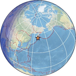
| Region | NEAR EAST COAST OF KAMCHATKA |
| Date time | 2026-07-30 21:53:26.2 UTC |
| Location | 53.074 ; 159.641 |
| Depth | 64 km |
| Distance | 1576 km ENE of Komsomolsk-on-Amur, Russia / pop: 275,000 / local time: 07:53:26.2 2026-07-31 68 km ENE of Petropavlovsk-Kamchatsky, Russia / pop: 187,000 / local time: 09:53:26.2 2026-07-31 |
Source parameters provided by:
National Earthquake Information Center, U.S. Geological Survey -- Golden, United States (NEIC)
All data providers for this event:
Seismological Survey of Serbia -- Belgrade, Serbia (BEO)HUN-REN EPSS Kövesligethy Radó Seismological Observato -- Budapest, Hungary (BUD)
Badan Meteorologi, Klimatologi dan Geofisika -- Jakarta, Indonesia (BMKG)
GeoForschungsZentrum (GFZ) -- Potsdam, Germany (GFZ)
Geophysical Survey of the Russian Academy of Sciences -- Obninsk, Russia (GSRAS)
Kandilli Observatory and Earthquake Research Institute -- Istanbul, Türkiye (KOERI)
Landsamt fur Geologie, Rohstoffe und Bergbau -- Freiburg, Germany (LED)
National Earthquake Information Center, U.S. Geological Survey -- Golden, United States (NEIC)
The research institute NORSAR -- Kjeller, Norway (NORSAR)
EMSC -- Arpajon, France (SC4)
Further information can be found at:
Geophysical Survey of the Russian Academy of Sciences -- Obninsk, Russia (GSRAS)National Earthquake Information Center, U.S. Geological Survey -- Golden, United States (NEIC)
GeoForschungsZentrum (GFZ) -- Potsdam, Germany (GFZ)