| Magnitude | 2.6 |
| Region | FRANCE-GERMANY BORDER REGION |
| Date time | 2026-06-17 10:10:04.3 UTC |
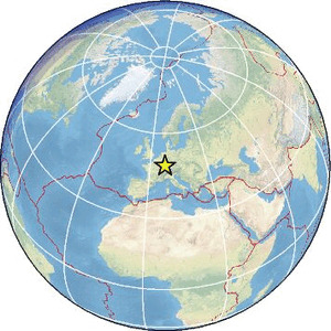
| Location | 48.668 ; 7.791 |
| Depth | 11 km |
| Distance | 59 km SW of Karlsruhe, Germany / pop: 283,000 / local time: 12:10:04.3 2026-06-17 10 km N of Strasbourg, France / pop: 274,000 / local time: 12:10:04.3 2026-06-17 |
Source parameters provided by:
All data providers for this event:
Bundesanstalt fur Geowissenschaften und Rohstoffe, German Regional Seismograph Network -- Hannover, Germany (BGR)Laboratoire de Detection et de Geophysique -- Bruyeres-le-Chatel, France (LDG)
Landsamt fur Geologie, Rohstoffe und Bergbau -- Freiburg, Germany (LED)
Geoazur (Universite Cote d'Azur, IRD, CNRS, Observatoire de la Cote d'Azur) -- Nice, France (OCA)
Reseau National de Surveillance Sismique -- Strasbourg, France (ReNaSS)
Further information can be found at:
Bundesanstalt fur Geowissenschaften und Rohstoffe, German Regional Seismograph Network -- Hannover, Germany (BGR)Laboratoire de Detection et de Geophysique -- Bruyeres-le-Chatel, France (LDG)
Landsamt fur Geologie, Rohstoffe und Bergbau -- Freiburg, Germany (LED)
Reseau National de Surveillance Sismique -- Strasbourg, France (ReNaSS)