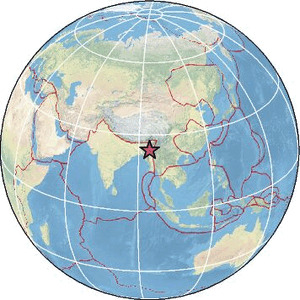
| Magnitude | 4.3 |
| Region | MYANMAR-INDIA BORDER REGION |
| Date time | 2026-06-07 05:12:26.0 UTC |
| Location | 24.098 ; 94.525 |
| Depth | 96 km |
| Distance | 98 km SE of Imphāl, India / pop: 223,000 / local time: 10:42:26.0 2026-06-07 52 km N of Mawlaik, Myanmar / pop: 44,500 / local time: 11:42:26.0 2026-06-07 |
Source parameters provided by:
India Meteorological Department, New Delhi, India -- New Delhi, India (NDI)
All data providers for this event:
India Meteorological Department, New Delhi, India -- New Delhi, India (NDI)Further information can be found at:
GeoForschungsZentrum (GFZ) -- Potsdam, Germany (GFZ)India Meteorological Department, New Delhi, India -- New Delhi, India (NDI)
National Earthquake Information Center, U.S. Geological Survey -- Golden, United States (NEIC)