| Magnitude | 5.2 |
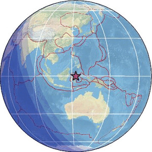
| Region | SULAWESI, INDONESIA |
| Date time | 2026-06-04 23:28:32.7 UTC |
| Location | -0.164 ; 123.061 |
| Depth | 129 km |
| Distance | 270 km SW of Manado, Indonesia / pop: 451,000 / local time: 07:28:32.7 2026-06-05 78 km S of Gorontalo, Indonesia / pop: 144,000 / local time: 07:28:32.7 2026-06-05 |
Source parameters provided by:
National Earthquake Information Center, U.S. Geological Survey -- Golden, United States (NEIC)
All data providers for this event:
British Geological Survey -- Edinburgh, United Kingdom (BGS)HUN-REN EPSS Kövesligethy Radó Seismological Observato -- Budapest, Hungary (BUD)
Badan Meteorologi, Klimatologi dan Geofisika -- Jakarta, Indonesia (BMKG)
GeoForschungsZentrum (GFZ) -- Potsdam, Germany (GFZ)
Geonet, GNS science -- Lower Hutt, New Zealand (GNS)
Geophysical Survey of the Russian Academy of Sciences -- Obninsk, Russia (GSRAS)
Instituto Portugues do Mar e da Atmosfera -- Lisbon, Portugal (IPMA)
Kandilli Observatory and Earthquake Research Institute -- Istanbul, Türkiye (KOERI)
National Earthquake Information Center, U.S. Geological Survey -- Golden, United States (NEIC)
EMSC -- Arpajon, France (SC4)
Further information can be found at:
GeoForschungsZentrum (GFZ) -- Potsdam, Germany (GFZ)Badan Meteorologi, Klimatologi dan Geofisika -- Jakarta, Indonesia (BMKG)
National Earthquake Information Center, U.S. Geological Survey -- Golden, United States (NEIC)