| Magnitude | 4.2 |
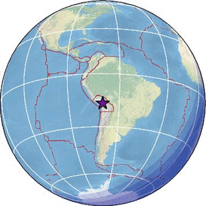
| Region | SOUTHERN PERU |
| Date time | 2026-05-12 18:32:39.1 UTC |
| Location | -16.863 ; -69.719 |
| Depth | 178 km |
| Distance | 118 km SSE of Puno, Peru / pop: 116,000 / local time: 13:32:39.1 2026-05-12 59 km NNE of Chuquitira, Peru / pop: 4,200 / local time: 13:32:39.1 2026-05-12 |
Source parameters provided by:
National Earthquake Information Center, U.S. Geological Survey -- Golden, United States (NEIC)
All data providers for this event:
GeoForschungsZentrum (GFZ) -- Potsdam, Germany (GFZ)Instituto Geofisico del Peru -- Lima, Peru (LIM)
National Earthquake Information Center, U.S. Geological Survey -- Golden, United States (NEIC)
Centro de Sismologia da Universidade de Sao Paulo (member of the RSBR) -- Sao Paulo, Brazil (USP)
Further information can be found at:
GeoForschungsZentrum (GFZ) -- Potsdam, Germany (GFZ)National Earthquake Information Center, U.S. Geological Survey -- Golden, United States (NEIC)
Instituto Geofisico del Peru -- Lima, Peru (LIM)
Departamento de Geofisica, Universidad de Chile -- Santiago, Chile (CSN)
Observatorio San Calixto -- La Paz, Bolivia (OSC)