| Magnitude | 4.4 |
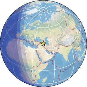
| Region | TURKEY-IRAN BORDER REGION |
| Date time | 2026-05-08 03:47:23.7 UTC |
| Location | 38.380 ; 44.969 |
| Depth | 10 km |
| Distance | 92 km NNW of Orūmīyeh, Iran / pop: 577,000 / local time: 07:17:23.7 2026-05-08 19 km SSE of Khowy, Iran / pop: 175,000 / local time: 07:17:23.7 2026-05-08 |
Source parameters provided by:
National Earthquake Information Center, U.S. Geological Survey -- Golden, United States (NEIC)
All data providers for this event:
Seismological Survey of Serbia -- Belgrade, Serbia (BEO)HUN-REN EPSS Kövesligethy Radó Seismological Observato -- Budapest, Hungary (BUD)
GeoForschungsZentrum (GFZ) -- Potsdam, Germany (GFZ)
Kandilli Observatory and Earthquake Research Institute -- Istanbul, Türkiye (KOERI)
Ukrainian NDC, Main Center of Special Monitoring -- Kyiv, Ukraine (MCSM)
National Earthquake Information Center, U.S. Geological Survey -- Golden, United States (NEIC)
National Survey of Seismic Protection -- Yerevan, Armenia (NSSP)
Republican Seismic Survey Center or Azerbaijan National Academy of Sciences -- Baku, Azerbaijan (RSSC)
Further information can be found at:
Disaster and Emergency Management Presidency, Earthquake Department (AFAD) -- Ankara, Türkiye (AFAD)International Institute for Earthquake Engineering and Seismology -- Tehran, Iran (IIEES)
Kandilli Observatory and Earthquake Research Institute -- Istanbul, Türkiye (KOERI)
Institute of Geophysics, University of Tehran -- Tehran, Iran (IGUT)