| Magnitude | 5.0 |
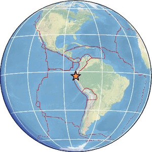
| Region | PERU-ECUADOR BORDER REGION |
| Date time | 2026-05-05 15:58:27.7 UTC |
| Location | -3.501 ; -80.549 |
| Depth | 56 km |
| Distance | 71 km WSW of Machala, Ecuador / pop: 198,000 / local time: 10:58:27.7 2026-05-05 13 km WNW of Tumbes, Peru / pop: 109,000 / local time: 10:58:27.7 2026-05-05 |
Source parameters provided by:
National Earthquake Information Center, U.S. Geological Survey -- Golden, United States (NEIC)
All data providers for this event:
GeoForschungsZentrum (GFZ) -- Potsdam, Germany (GFZ)Instituto Geofisico del Peru -- Lima, Peru (LIM)
National Earthquake Information Center, U.S. Geological Survey -- Golden, United States (NEIC)
Escuela Politecnica Nacional, Quito, Ecuador -- Quito, Ecuador (QUI)
EMSC -- Arpajon, France (SC4)
Further information can be found at:
Instituto Geofisico del Peru -- Lima, Peru (LIM)GeoForschungsZentrum (GFZ) -- Potsdam, Germany (GFZ)
Escuela Politecnica Nacional, Quito, Ecuador -- Quito, Ecuador (QUI)
National Earthquake Information Center, U.S. Geological Survey -- Golden, United States (NEIC)