| Magnitude | 4.2 |
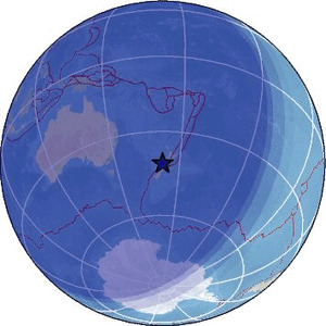
| Region | SOUTH ISLAND OF NEW ZEALAND |
| Date time | 2026-04-29 14:55:23.0 UTC |
| Location | -41.387 ; 171.912 |
| Depth | 429 km |
| Distance | 239 km WSW of Wellington, New Zealand / pop: 381,000 / local time: 02:55:23.0 2026-04-30 48 km NNE of Westport, New Zealand / pop: 4,200 / local time: 02:55:23.0 2026-04-30 |
Source parameters provided by:
Geonet, GNS science -- Lower Hutt, New Zealand (GNS)
All data providers for this event:
Geonet, GNS science -- Lower Hutt, New Zealand (GNS)Further information can be found at:
National Earthquake Information Center, U.S. Geological Survey -- Golden, United States (NEIC)Geonet, GNS science -- Lower Hutt, New Zealand (GNS)
GeoForschungsZentrum (GFZ) -- Potsdam, Germany (GFZ)