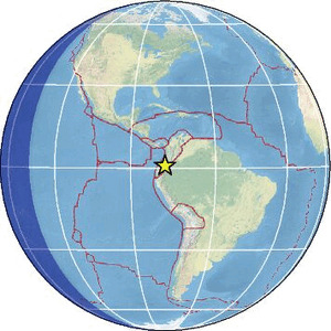
| Magnitude | 3.2 |
| Region | COLOMBIA-ECUADOR BORDER REGION |
| Date time | 2026-03-27 14:49:18.6 UTC |
| Location | 0.810 ; -77.950 |
| Depth | 5 km |
| Distance | 54 km N of Ibarra, Ecuador / pop: 132,000 / local time: 09:49:18.6 2026-03-27 26 km W of Tulcán, Ecuador / pop: 86,400 / local time: 09:49:18.6 2026-03-27 |
Source parameters provided by:
Escuela Politecnica Nacional, Quito, Ecuador -- Quito, Ecuador (QUI)
All data providers for this event:
Instituto Nicaraguense de Estudios Territoriales -- Managua, Nicaragua (INET)Escuela Politecnica Nacional, Quito, Ecuador -- Quito, Ecuador (QUI)
Further information can be found at:
Instituto Geofisico del Peru -- Lima, Peru (LIM)GeoForschungsZentrum (GFZ) -- Potsdam, Germany (GFZ)
Red Sismica Nacional de Colombia, INGEOMINAS, Bogota, Colombia -- Bogota, Colombia (RSNC)
National Earthquake Information Center, U.S. Geological Survey -- Golden, United States (NEIC)
Escuela Politecnica Nacional, Quito, Ecuador -- Quito, Ecuador (QUI)