| Magnitude | 4.7 |
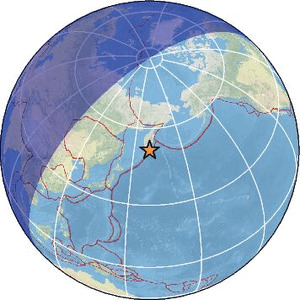
| Region | OFF EAST COAST OF KAMCHATKA |
| Date time | 2026-03-13 22:56:38.6 UTC |
| Location | 51.600 ; 159.550 |
| Depth | 50 km |
| Distance | 1547 km NE of Asahikawa, Japan / pop: 356,000 / local time: 07:56:38.6 2026-03-14 174 km SSE of Petropavlovsk-Kamchatsky, Russia / pop: 187,000 / local time: 10:56:38.6 2026-03-14 |
Source parameters provided by:
Geophysical Survey of the Russian Academy of Sciences -- Obninsk, Russia (GSRAS)
All data providers for this event:
Seismological Survey of Serbia -- Belgrade, Serbia (BEO)National Institute for Earth Physics -- Bucharest, Romania (NIEP)
GeoForschungsZentrum (GFZ) -- Potsdam, Germany (GFZ)
Geophysical Survey of the Russian Academy of Sciences -- Obninsk, Russia (GSRAS)
Ukrainian NDC, Main Center of Special Monitoring -- Kyiv, Ukraine (MCSM)
National Earthquake Information Center, U.S. Geological Survey -- Golden, United States (NEIC)
The research institute NORSAR -- Kjeller, Norway (NORSAR)
EMSC -- Arpajon, France (SC4)
Further information can be found at:
National Earthquake Information Center, U.S. Geological Survey -- Golden, United States (NEIC)Geophysical Survey of the Russian Academy of Sciences -- Obninsk, Russia (GSRAS)
GeoForschungsZentrum (GFZ) -- Potsdam, Germany (GFZ)