| Magnitude | 3.8 |
| Region | CHIAPAS, MEXICO |
| Date time | 2026-02-27 20:43:11.0 UTC |
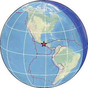
| Location | 15.072 ; -92.652 |
| Depth | 96 km |
| Distance | 46 km WNW of Tapachula, Mexico / pop: 202,000 / local time: 14:43:11.0 2026-02-27 18 km SSW of Villa Comaltitlán, Mexico / pop: 7,200 / local time: 14:43:11.0 2026-02-27 |
Source parameters provided by:
Servicio Sismologico Nacional, Instituto de Geofisica, UNAM -- Mexico City, Mexico (UNM)
All data providers for this event:
Servicio Sismologico Nacional, Instituto de Geofisica, UNAM -- Mexico City, Mexico (UNM)Further information can be found at:
GeoForschungsZentrum (GFZ) -- Potsdam, Germany (GFZ)Servicio Sismologico Nacional, Instituto de Geofisica, UNAM -- Mexico City, Mexico (UNM)
National Earthquake Information Center, U.S. Geological Survey -- Golden, United States (NEIC)