| Magnitude | 3.4 |
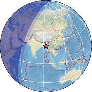
| Region | MYANMAR-INDIA BORDER REGION |
| Date time | 2026-02-22 01:41:49.0 UTC |
| Location | 22.510 ; 93.480 |
| Depth | 90 km |
| Distance | 156 km SE of Aizawl, India / pop: 265,000 / local time: 07:11:49.0 2026-02-22 20 km SSW of Hakha, Myanmar / pop: 20,000 / local time: 08:11:49.0 2026-02-22 |
Source parameters provided by:
India Meteorological Department, New Delhi, India -- New Delhi, India (NDI)
All data providers for this event:
India Meteorological Department, New Delhi, India -- New Delhi, India (NDI)Further information can be found at:
GeoForschungsZentrum (GFZ) -- Potsdam, Germany (GFZ)India Meteorological Department, New Delhi, India -- New Delhi, India (NDI)
National Earthquake Information Center, U.S. Geological Survey -- Golden, United States (NEIC)