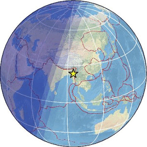
| Magnitude | 5.2 |
| Region | MYANMAR |
| Date time | 2026-02-06 00:33:06.4 UTC |
| Location | 23.511 ; 94.948 |
| Depth | 10 km |
| Distance | 157 km NNW of Monywa, Myanmar / pop: 182,000 / local time: 07:03:06.4 2026-02-06 57 km E of Mawlaik, Myanmar / pop: 44,500 / local time: 07:03:06.4 2026-02-06 |
Source parameters provided by:
National Earthquake Information Center, U.S. Geological Survey -- Golden, United States (NEIC)
All data providers for this event:
Geoscience Australia, Canberra, ACT, Australia -- Canberra, Australia (AUST)Seismological Survey of Serbia -- Belgrade, Serbia (BEO)
HUN-REN EPSS Kövesligethy Radó Seismological Observato -- Budapest, Hungary (BUD)
GeoForschungsZentrum (GFZ) -- Potsdam, Germany (GFZ)
Slovenian Environment Agency, Seismology Office -- Ljubljana, Slovenia (ARSO)
Malaysian Meteorological Department -- Kuala Lumpur, Malaysia (MET)
India Meteorological Department, New Delhi, India -- New Delhi, India (NDI)
National Earthquake Information Center, U.S. Geological Survey -- Golden, United States (NEIC)
The research institute NORSAR -- Kjeller, Norway (NORSAR)
EMSC -- Arpajon, France (SC4)
Thailand Seismological Bureau -- Bangkok, Thailand (TSB)
Further information can be found at:
GeoForschungsZentrum (GFZ) -- Potsdam, Germany (GFZ)National Earthquake Information Center, U.S. Geological Survey -- Golden, United States (NEIC)