| Magnitude | 3.7 |
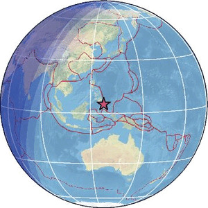
| Region | PHILIPPINE ISLANDS REGION |
| Date time | 2026-01-30 23:54:14.0 UTC |
| Location | 5.060 ; 127.420 |
| Depth | 109 km |
| Distance | 249 km SE of Mati, Philippines / pop: 105,000 / local time: 07:54:14.0 2026-01-31 200 km SE of Pondaguitan, Philippines / pop: 2,100 / local time: 07:54:14.0 2026-01-31 |
Source parameters provided by:
Badan Meteorologi, Klimatologi dan Geofisika -- Jakarta, Indonesia (BMKG)
All data providers for this event:
Badan Meteorologi, Klimatologi dan Geofisika -- Jakarta, Indonesia (BMKG)Further information can be found at:
GeoForschungsZentrum (GFZ) -- Potsdam, Germany (GFZ)National Earthquake Information Center, U.S. Geological Survey -- Golden, United States (NEIC)
Philippine Inst. of Volcanology and Seismology, Quezon City, Philippines -- Manila, Philippines (PIVS)
Badan Meteorologi, Klimatologi dan Geofisika -- Jakarta, Indonesia (BMKG)