| Magnitude | 3.2 |
| Region | OFFSHORE EL SALVADOR |
| Date time | 2026-01-28 16:46:20.0 UTC |
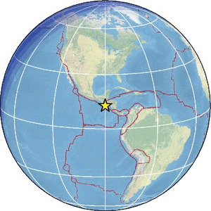
| Location | 12.730 ; -90.050 |
| Depth | 8 km |
| Distance | 134 km SSW of Santa Tecla, El Salvador / pop: 124,000 / local time: 10:46:20.0 2026-01-28 99 km S of Acajutla, El Salvador / pop: 22,700 / local time: 10:46:20.0 2026-01-28 |
Source parameters provided by:
Instituto Nicaraguense de Estudios Territoriales -- Managua, Nicaragua (INET)
All data providers for this event:
Instituto Nicaraguense de Estudios Territoriales -- Managua, Nicaragua (INET)Further information can be found at:
GeoForschungsZentrum (GFZ) -- Potsdam, Germany (GFZ)Instituto Nicaraguense de Estudios Territoriales -- Managua, Nicaragua (INET)
National Earthquake Information Center, U.S. Geological Survey -- Golden, United States (NEIC)
Servicio Sismologico Nacional, Instituto de Geofisica, UNAM -- Mexico City, Mexico (UNM)
Servicio Nacional de Estudios Territoriales (SNET El Salvador) -- San Salvador, El Salvador (MARN)