| Magnitude | 5.2 |
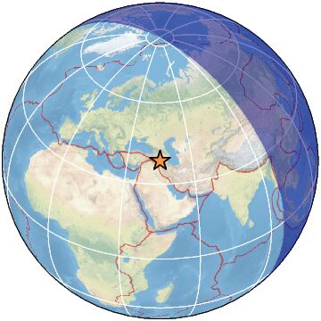
| Region | NORTHWESTERN IRAN |
| Date time | 2023-03-16 11:47:20.0 UTC |
| Location | 38.477 ; 45.135 |
| Depth | 52 km |
| Distance | 103 km N of Orūmīyeh, Iran / pop: 577,000 / local time: 15:17:20.0 2023-03-16 18 km ESE of Khowy, Iran / pop: 175,000 / local time: 15:17:20.0 2023-03-16 |
All data providers for this event:
Geoscience Australia, Canberra, ACT, Australia -- Canberra, Australia (AUST)Centro de Sismologia da Universidade de Sao Paulo (member of the RSBR) -- Sao Paulo, Brazil (USP)
Seismological Survey of Serbia -- Belgrade, Serbia (BEO)
GeoForschungsZentrum (GFZ) -- Potsdam, Germany (GFZ)
Republican Seismic Survey Center or Azerbaijan National Academy of Sciences -- Baku, Azerbaijan (RSSC)
Instituto Portugues do Mar e da Atmosfera -- Lisbon, Portugal (IPMA)
Bundesanstalt fur Geowissenschaften und Rohstoffe, German Regional Seismograph Network -- Hannover, Germany (BGR)
National Earthquake Information Center, U.S. Geological Survey -- Golden, United States (NEIC)
Disaster and Emergency Management Presidency, Earthquake Department (AFAD) -- Ankara, Türkiye (AFAD)
Slovenian Environment Agency, Seismology Office -- Ljubljana, Slovenia (ARSO)
National Institute for Earth Physics -- Bucharest, Romania (NIEP)
Ukrainian NDC, Main Center of Special Monitoring -- Kyiv, Ukraine (MCSM)
Malaysian Meteorological Department -- Kuala Lumpur, Malaysia (MET)
HUN-REN EPSS Kövesligethy Radó Seismological Observato -- Budapest, Hungary (BUD)
International Institute for Earthquake Engineering and Seismology -- Tehran, Iran (IIEES)
Badan Meteorologi, Klimatologi dan Geofisika -- Jakarta, Indonesia (BMKG)
Geophysical Survey of the Russian Academy of Sciences -- Obninsk, Russia (GSRAS)
National Survey of Seismic Protection -- Yerevan, Armenia (NSSP)
Further information can be found at:
Geophysical Survey of the Russian Academy of Sciences -- Obninsk, Russia (GSRAS)Institute of Geophysics, University of Tehran -- Tehran, Iran (IGUT)
International Institute for Earthquake Engineering and Seismology -- Tehran, Iran (IIEES)